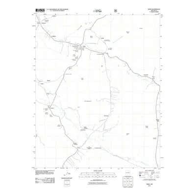
2011 Map of Mora
USGS Topo · Published 2011About this map
The Mora Valley serves as a primary corridor for historic settlement and agriculture, anchored by the Mora Historic District and the iconic Saint Vrains Mill. In the early 21st century, this landscape preserves several concentrated areas of cultural heritage, including the Ledoux Rural Historic District and the North Carmen Historic District. The distribution of cemeteries across the terrain—ranging from the San Antonio Cemetery in the north to Laumbachs Cemetery in the southeast—reflects a long-standing community structure tied to family landholdings and small rural outposts.
Find a feature on this map
68 named features on this map. Tap any name to fly to it.
Don’t see what you’re looking for? This feature index may not catch every label — zoom into the map to look around manually.
Map Details
Editions of this 2011 Mora Map
This is the sole edition of this map. No revisions or reprints were ever made.
Other maps of this area

1889 · Las Vegas
USGS Topo · 1:125,000

1891 · Las Vegas
USGS Topo · 1:125,000

1893 · Las Vegas
USGS Topo · 1:125,000

1954 · Santa Fe
USGS Topo · 1:250,000

1954 · Raton
USGS Topo · 1:250,000

1958 · Raton
USGS Topo · 1:250,000

1958 · Santa Fe
USGS Topo · 1:250,000

1963 · Lake Isabel
USGS Topo · 1:24,000

1963 · Rainsville
USGS Topo · 1:24,000
1965 · Rociada
USGS Topo · 1:24,000