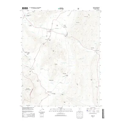
2013 Map of Mora
USGS Topo · Published 2013About this map
Santa Gertrudes Cem and Saint Vrain Cem sit just north of the village of Mora, a settlement defined by its position in the Mora Valley where the Mora River flows eastward. This landscape is a complex of deep valleys and rising peaks, including Eagle Peak and the El Oro Mountains. Significant ranching and agricultural history is visible through landmarks like the Jose Olguin Barn and Corral Complex in El Alto. To the south, the communities of North Carmen and South Carmen are situated near the Rito Cebolla, while the southwestern corner of the map reaches into the protected timberlands of the Santa Fe National Forest. Family and parish history is well-preserved through numerous burial sites including Saint Gertrude Cem, Presbyterian Cem, and Quintana Cem.
Find a feature on this map
64 named features on this map. Tap any name to fly to it.
Don’t see what you’re looking for? This feature index may not catch every label — zoom into the map to look around manually.
Map Details
Editions of this 2013 Mora Map
This is the sole edition of this map. No revisions or reprints were ever made.
Other maps of this area

1889 · Las Vegas
USGS Topo · 1:125,000

1891 · Las Vegas
USGS Topo · 1:125,000

1893 · Las Vegas
USGS Topo · 1:125,000

1954 · Santa Fe
USGS Topo · 1:250,000

1954 · Raton
USGS Topo · 1:250,000

1958 · Raton
USGS Topo · 1:250,000

1958 · Santa Fe
USGS Topo · 1:250,000

1963 · Lake Isabel
USGS Topo · 1:24,000

1963 · Rainsville
USGS Topo · 1:24,000
1965 · Rociada
USGS Topo · 1:24,000