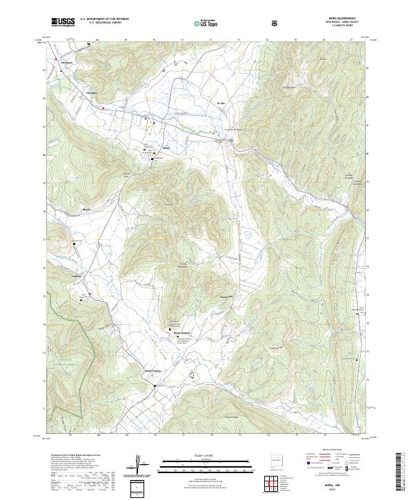
2023 Map of Mora
USGS Topo · Published 2023About this map
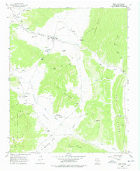
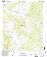
Mora sits as a central settlement in this high-altitude valley, where the Mora River and its tributaries define the human geography of the Sangre de Cristo foothills. The landscape is characterized by a dense network of traditional villages such as Cleveland, Cordillera, and North Carmen, each maintaining a distinct identity through community landmarks like Saint Vrain Cem and Our Lady of Mount Carmel Catholic Church Yard. The presence of the Mora National Fish Hatchery highlights the importance of water management in this arid region, while the surrounding El Oro Mountains and Santa Fe National Forest provide a dramatic backdrop to the dispersed agricultural settlements. This topographic study reveals a complex system of local roads, such as El Carmel Rd and Monte Aplanado Rd, that link the various canyons and mountain passes used by residents for generations.
Find a feature on this map
75 named features on this map. Tap any name to fly to it.
Don’t see what you’re looking for? This feature index may not catch every label — zoom into the map to look around manually.
Map Details
Editions of this 2023 Mora Map
This is the sole edition of this map. No revisions or reprints were ever made.