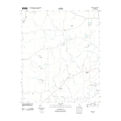
2011 Map of Moran
USGS Topo · Published 2011About this map
Sandy Point and Moran anchor this section of Georgia, where a complex network of creeks and small private reservoirs defines the landscape. The geography is heavily influenced by the drainage basins of Echeconnee Creek and its many tributaries, including Little Echeconnee Creek and Walnut Creek. These waterways are dotted with several dammed features such as Hughes Lake, Mosely Lake, and Huneycut Lake, illustrating a pattern of local water management and recreation.
Find a feature on this map
62 named features on this map. Tap any name to fly to it.
Don’t see what you’re looking for? This feature index may not catch every label — zoom into the map to look around manually.
Map Details
Editions of this 2011 Moran Map
This is the sole edition of this map. No revisions or reprints were ever made.
Other maps of this area

1951 · Yatesville
USGS Topo · 1:62,500

1955 · Phenix City
USGS Topo · 1:250,000

1956 · Fort Valley
USGS Topo · 1:62,500

1956 · Bolingbroke
USGS Topo · 1:62,500

1957 · Phenix City
USGS Topo · 1:250,000

1957 · Macon
USGS Topo · 1:250,000

1958 · Macon
USGS Topo · 1:250,000

1958 · Phenix City
USGS Topo · 1:250,000

1964 · Macon
USGS Topo · 1:250,000
1971 · Roberta
USGS Topo · 1:24,000