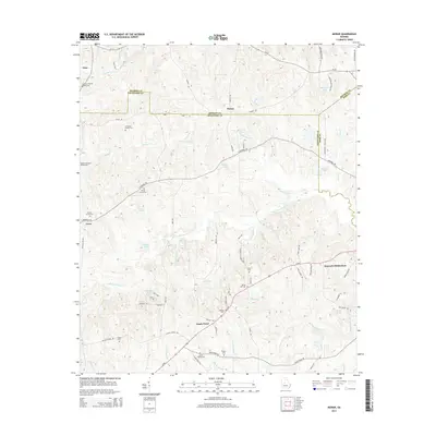
2014 Map of Moran
USGS Topo · Published 2014About this map
The boundary lines of Monroe, Crawford, and Bibb counties converge in this rural landscape, defined by a dense network of family burial grounds and small settlements. Named for a local community, Moran sits at the intersection of Tharpe Rd and Bagley Rd, while Sandy Point and Ceres anchor the southern and western reaches. The area is notable for its genealogical richness, preserved through numerous private family plots such as the A G Smith Family Cem, Marshall-Parsons Family Cem, and Bowen Family Cem.
Find a feature on this map
76 named features on this map. Tap any name to fly to it.
Don’t see what you’re looking for? This feature index may not catch every label — zoom into the map to look around manually.
Map Details
Editions of this 2014 Moran Map
This is the sole edition of this map. No revisions or reprints were ever made.
Other maps of this area

1951 · Yatesville
USGS Topo · 1:62,500

1955 · Phenix City
USGS Topo · 1:250,000

1956 · Fort Valley
USGS Topo · 1:62,500

1956 · Bolingbroke
USGS Topo · 1:62,500

1957 · Phenix City
USGS Topo · 1:250,000

1957 · Macon
USGS Topo · 1:250,000

1958 · Macon
USGS Topo · 1:250,000

1958 · Phenix City
USGS Topo · 1:250,000

1964 · Macon
USGS Topo · 1:250,000
1971 · Roberta
USGS Topo · 1:24,000