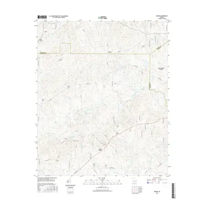
2017 Map of Moran
USGS Topo · Published 2017About this map
The boundary lines of Monroe, Crawford, and Bibb counties converge in this landscape of rural settlements and family burial grounds north of Sandy Point. The terrain is defined by the winding course of Echeconnee Creek and its many tributaries, including Little Echeconnee Creek and Sweetwater Creek. This drainage system created numerous basins for small water bodies like Hatcher Lake, Mosely Lake, and Walker Lake.
Find a feature on this map
73 named features on this map. Tap any name to fly to it.
Don’t see what you’re looking for? This feature index may not catch every label — zoom into the map to look around manually.
Map Details
Editions of this 2017 Moran Map
This is the sole edition of this map. No revisions or reprints were ever made.
Other maps of this area

1951 · Yatesville
USGS Topo · 1:62,500

1955 · Phenix City
USGS Topo · 1:250,000

1956 · Fort Valley
USGS Topo · 1:62,500

1956 · Bolingbroke
USGS Topo · 1:62,500

1957 · Phenix City
USGS Topo · 1:250,000

1957 · Macon
USGS Topo · 1:250,000

1958 · Macon
USGS Topo · 1:250,000

1958 · Phenix City
USGS Topo · 1:250,000

1964 · Macon
USGS Topo · 1:250,000
1971 · Roberta
USGS Topo · 1:24,000