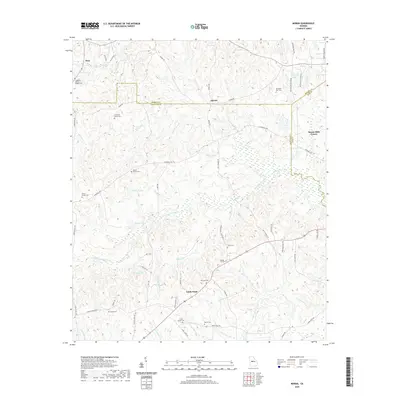
2020 Map of Moran
USGS Topo · Published 2020About this map
The boundary of Monroe, Crawford, and Bibb counties converges in this landscape defined by the intricate tributaries of Echeconnee Creek. The area is characterized by a dense distribution of family burial grounds and small community landmarks, reflecting a deep-rooted rural settlement pattern. Significant genealogy resources are scattered across the terrain, including the Anderson - Barnes - Bagley Cemetery and the McCallum - Hart Cemetery near the community of McCallum. Central to the geography are numerous private lakes such as Mosely Lake, Hatcher Lake, and Walker Lake, which punctuate the woodlands between Sandy Point and Moran. Waterways like Little Echeconnee Creek and Sweetwater Creek carve through the landscape, while long-established routes like East Hopewell Road and Tharpe Road connect the dispersed farmsteads and churches like Salem Church.
Find a feature on this map
72 named features on this map. Tap any name to fly to it.
Don’t see what you’re looking for? This feature index may not catch every label — zoom into the map to look around manually.
Map Details
Editions of this 2020 Moran Map
This is the sole edition of this map. No revisions or reprints were ever made.
Other maps of this area

1951 · Yatesville
USGS Topo · 1:62,500

1955 · Phenix City
USGS Topo · 1:250,000

1956 · Fort Valley
USGS Topo · 1:62,500

1956 · Bolingbroke
USGS Topo · 1:62,500

1957 · Phenix City
USGS Topo · 1:250,000

1957 · Macon
USGS Topo · 1:250,000

1958 · Macon
USGS Topo · 1:250,000

1958 · Phenix City
USGS Topo · 1:250,000

1964 · Macon
USGS Topo · 1:250,000
1971 · Roberta
USGS Topo · 1:24,000