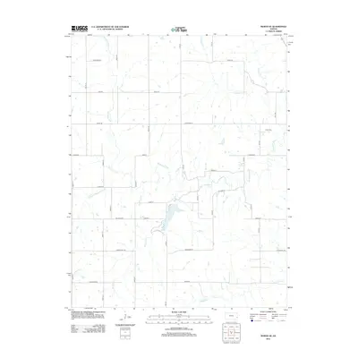
2012 Map of Moran SE
USGS Topo · Published 2012About this map
The Marmaton River and its numerous tributaries, including Wolfpen Cr and Schubert Cr, carve a complex drainage pattern across this Bourbon County landscape. The area is defined by a rigid section-line road grid that overlays the natural hydrology, with routes like Kansas Rd, Indian St, and California Rd providing access to the interior rural acreage. This interplay between the geometric human survey and the meandering river systems reveals a landscape deeply committed to agriculture. The presence of Hatch Cem near the eastern margin suggests a localized center of historical family settlement. Other water features, such as Jackie Br Marmaton River and Tennyson Cr, further illustrate the well-watered nature of these Kansas plains during the early twenty-first century.
Find a feature on this map
38 named features on this map. Tap any name to fly to it.
Don’t see what you’re looking for? This feature index may not catch every label — zoom into the map to look around manually.
Map Details
Editions of this 2012 Moran SE Map
This is the sole edition of this map. No revisions or reprints were ever made.
Other maps of this area

1884 · Fort Scott
USGS Topo · 1:125,000

1886 · Iola
USGS Topo · 1:125,000

1886 · Fort Scott
USGS Topo · 1:125,000

1893 · Fort Scott
USGS Topo · 1:125,000

1893 · Iola
USGS Topo · 1:125,000

1904 · Iola
USGS Topo · 1:125,000

1947 · Joplin
USGS Topo · 1:250,000

1948 · Erie
USGS Topo · 1:62,500

1948 · Girard
USGS Topo · 1:62,500

1949 · Erie
USGS Topo · 1:62,500