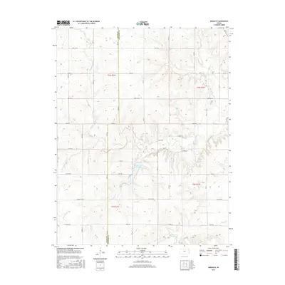
2015 Map of Moran SE
USGS Topo · Published 2015About this map
Bourbon County State Lake forms a central geographical point in this rural landscape, capturing the drainage from Wolfpen Cr and surrounding draws. The hydrology of the region is dominated by the Marmaton River, which meanders across the western and southern portions of the territory, joined by tributaries such as Schubert Cr and Tennyson Cr. This 2015 survey reflects a strictly agricultural and conservation-focused layout, where the section-line road system is established by named routes like Indian Rd and Kansas Rd. Evidence of early settlement persists at Hatch Cem, located near the intersection of Limestone Rd and 50th St. The terrain is characterized by the dissected uplands typical of the border between Bourbon and Allen counties, where small watercourses like Hinton Cr have carved distinct drainage patterns into the prairie.
Find a feature on this map
43 named features on this map. Tap any name to fly to it.
Don’t see what you’re looking for? This feature index may not catch every label — zoom into the map to look around manually.
Map Details
Editions of this 2015 Moran SE Map
This is the sole edition of this map. No revisions or reprints were ever made.
Other maps of this area

1884 · Fort Scott
USGS Topo · 1:125,000

1886 · Iola
USGS Topo · 1:125,000

1886 · Fort Scott
USGS Topo · 1:125,000

1893 · Fort Scott
USGS Topo · 1:125,000

1893 · Iola
USGS Topo · 1:125,000

1904 · Iola
USGS Topo · 1:125,000

1947 · Joplin
USGS Topo · 1:250,000

1948 · Erie
USGS Topo · 1:62,500

1948 · Girard
USGS Topo · 1:62,500

1949 · Erie
USGS Topo · 1:62,500