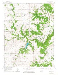
1966 Map of Moran SE
USGS Topo · Published 1967About this map
The Marmaton River meanders across this landscape on the Bourbon and Allen County border, carving through the terrain where the Old Indian Treaty Boundary historically divided the land. In the heart of the region, the Bourbon County State Park serves as a significant recreational anchor, surrounding a large reservoir fed by local drainages. The area is characterized by a mix of agricultural activity and industrial extraction, evidenced by scattered Oil Field operations, Oil Wells, and several Quarries.
Find a feature on this map
22 named features on this map. Tap any name to fly to it.
Don’t see what you’re looking for? This feature index may not catch every label — zoom into the map to look around manually.
Map Details
Editions of this 1966 Moran SE Map
This is the sole edition of this map. No revisions or reprints were ever made.
Other maps of this area

1884 · Fort Scott
USGS Topo · 1:125,000

1886 · Iola
USGS Topo · 1:125,000

1886 · Fort Scott
USGS Topo · 1:125,000

1893 · Fort Scott
USGS Topo · 1:125,000

1893 · Iola
USGS Topo · 1:125,000

1904 · Iola
USGS Topo · 1:125,000

1947 · Joplin
USGS Topo · 1:250,000

1948 · Erie
USGS Topo · 1:62,500

1948 · Girard
USGS Topo · 1:62,500

1949 · Erie
USGS Topo · 1:62,500