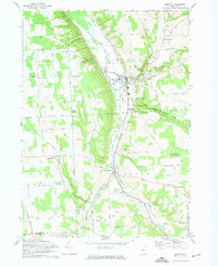
1971 Map of Moravia
USGS Topo · Published 1974About this map
The Owasco Inlet carves a deep valley through Cayuga County, serving as the central corridor for both the Lehigh Valley Railroad and the industrial hub of Moravia. The village is dense with local history, featuring the Moravia Mill, a Fairgrounds, and numerous cemeteries including St Patricks Cem and the distinctive Indian Mound Cem. Surrounding the valley, the landscape rises sharply toward Owasco Hill and Jewett Hill, where a network of family-named crossroads like Perkins Corners and Rafferty Corners dot the plateau.
Find a feature on this map
66 named features on this map. Tap any name to fly to it.
Don’t see what you’re looking for? This feature index may not catch every label — zoom into the map to look around manually.
Map Details
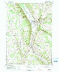
Editions of this 1971 Moravia Map
2 editions found
Other maps of this area

1898 · Moravia
USGS Topo · 1:62,500

1899 · Auburn
USGS Topo · 1:62,500

1899 · Skaneateles
USGS Topo · 1:62,500

1902 · Skaneateles
USGS Topo · 1:62,500

1902 · Moravia
USGS Topo · 1:62,500

1902 · Genoa
USGS Topo · 1:62,500

1902 · Auburn
USGS Topo · 1:62,500

1942 · Ludlowville
USGS Topo · 1:24,000

1942 · Groton
USGS Topo · 1:24,000

1942 · Genoa
USGS Topo · 1:24,000