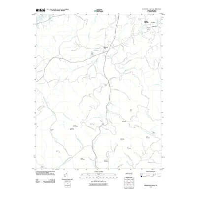
2010 Map of Moravian Falls
USGS Topo · Published 2010About this map
Moravian Falls serves as the focal point of this Wilkes County landscape, where the foothills meet the rising heights of the Brushy Mountains. The terrain is defined by a dense network of ridges and gaps, including Kilby Gap and Cove Gap, which historically dictated the movement of goods and people through the region. Water management is a prominent theme on this sheet, evidenced by infrastructure like Yellow Jacket Lake Dam, Ritchie Dam, and Bentley Dam along the many creeks that feed into the South Yadkin River.
Find a feature on this map
80 named features on this map. Tap any name to fly to it.
Don’t see what you’re looking for? This feature index may not catch every label — zoom into the map to look around manually.
Map Details
Editions of this 2010 Moravian Falls Map
This is the sole edition of this map. No revisions or reprints were ever made.
Other maps of this area

1889 · Wilkesboro
USGS Topo · 1:125,000

1891 · Wilkesboro
USGS Topo · 1:125,000

1895 · Hickory
USGS Topo · 1:125,000

1953 · Charlotte
USGS Topo · 1:250,000

1953 · Winston-Salem
USGS Topo · 1:250,000

1954 · Charlotte
USGS Topo · 1:250,000

1955 · Winston-Salem
USGS Topo · 1:250,000

1960 · Charlotte
USGS Topo · 1:250,000

1962 · Winston-Salem
USGS Topo · 1:250,000

1962 · Charlotte
USGS Topo · 1:250,000