2022 Map of Moravian Falls
USGS Topo · Published 2022About this map
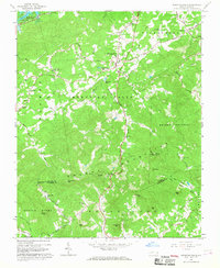
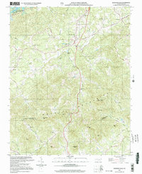
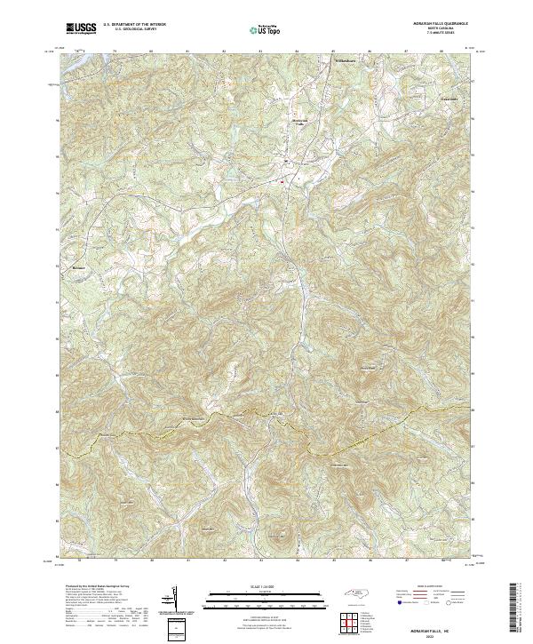
The Brushy Mountains dominate the southern portion of this region, forming a prominent natural boundary between Wilkes and Alexander Counties. This mountain chain is punctuated by high points such as Pores Knob and Chestnut Mtn, while natural passages like Cove Gap and Kilby Gap suggest the historical routes used to navigate the terrain. The community of Moravian Falls serves as a central hub, situated near the headwaters of Moravian Cr and the waters of Yellow Jacket Lake. In the northern reaches, the outskirts of Wilkesboro and the settlement of Oakwoods indicate the modern expansion of residential development. To the south and west, the landscape is defined by the headwaters of the S Yadkin River and the Lower Little River. Genealogists may find interest in the Lebanon Cem near Boomer, as well as numerous family-named roads like Lona Daniels Loop and Daniels Ridge Rd that hint at long-standing local homesteads.
Find a feature on this map
132 named features on this map. Tap any name to fly to it.
Don’t see what you’re looking for? This feature index may not catch every label — zoom into the map to look around manually.
Map Details
Editions of this 2022 Moravian Falls Map
This is the sole edition of this map. No revisions or reprints were ever made.
Historical Maps of Quail Hollow Estates Through Time
3 maps found