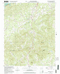
2000 Map of Moravian Falls
USGS Topo · Published 2003About this map
The Brushy Mountains dominate this landscape south of Wilkesboro, where the terrain breaks sharply between the Yadkin River basin and the headwaters of the Lower Little River. At the foot of these slopes, the community of Moravian Falls serves as a central hub, connected by a winding network of rural routes including Falls Road and Brushy Mtn Road. The map reveals a deeply rooted religious and social geography, marked by numerous country churches such as Mt Carmel Ch, Piney Grove Ch, and Walnut Grove Ch.
Find a feature on this map
46 named features on this map. Tap any name to fly to it.
Don’t see what you’re looking for? This feature index may not catch every label — zoom into the map to look around manually.
Map Details
Editions of this 2000 Moravian Falls Map
This is the sole edition of this map. No revisions or reprints were ever made.
Other maps of this area

1889 · Wilkesboro
USGS Topo · 1:125,000

1891 · Wilkesboro
USGS Topo · 1:125,000

1895 · Hickory
USGS Topo · 1:125,000

1953 · Charlotte
USGS Topo · 1:250,000

1953 · Winston-Salem
USGS Topo · 1:250,000

1954 · Charlotte
USGS Topo · 1:250,000

1955 · Winston-Salem
USGS Topo · 1:250,000

1960 · Charlotte
USGS Topo · 1:250,000

1962 · Winston-Salem
USGS Topo · 1:250,000

1962 · Charlotte
USGS Topo · 1:250,000