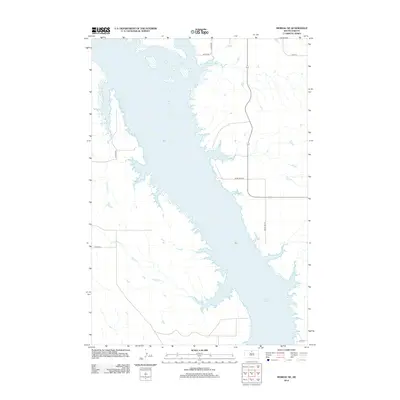
2012 Map of Moreau NE
USGS Topo · Published 2012About this map
Lake Oahe dominates this Corson County landscape, showing the Missouri River's reservoir as it appeared in the early 2010s. The map illustrates the intricate, flooded coulees and points that characterize this section of the reservoir, with notable inflows from Le Compte Cr and Little Bear Cr entering from the west. The terrain is defined by the high bluffs overlooking the water, carved by these drainage systems.
Find a feature on this map
12 named features on this map. Tap any name to fly to it.
Don’t see what you’re looking for? This feature index may not catch every label — zoom into the map to look around manually.
Map Details
Editions of this 2012 Moreau NE Map
This is the sole edition of this map. No revisions or reprints were ever made.
Other maps of this area

1953 · McIntosh
USGS Topo · 1:250,000

1958 · McIntosh
USGS Topo · 1:250,000

1967 · Glenham
USGS Topo · 1:24,000

1967 · Selby SW
USGS Topo · 1:24,000

1967 · Mobridge
USGS Topo · 1:24,000

1968 · Moreau NW
USGS Topo · 1:24,000

1968 · Moreau NE
USGS Topo · 1:24,000

1968 · Akaska NW
USGS Topo · 1:24,000

1968 · Akaska SW
USGS Topo · 1:24,000

1968 · Moreau
USGS Topo · 1:24,000