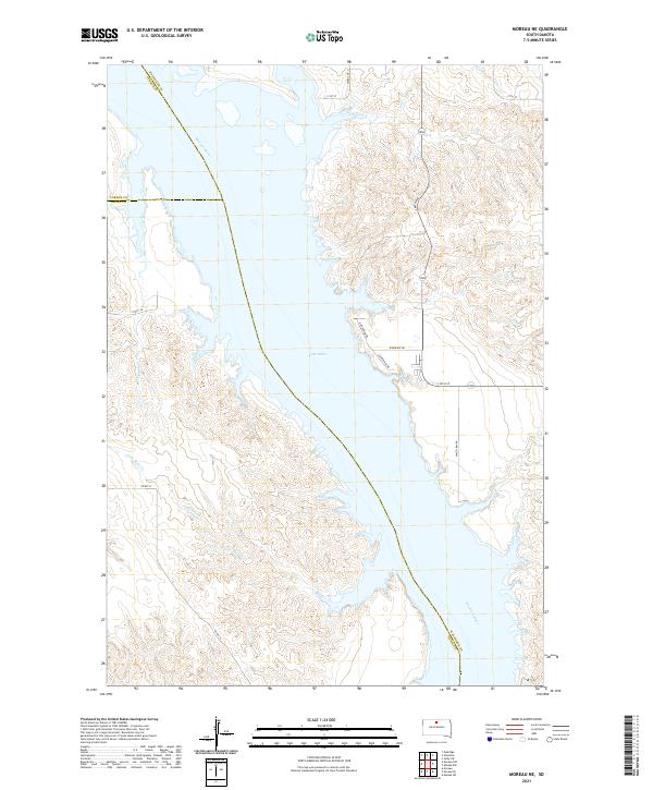
2021 Map of Moreau NE
USGS Topo · Published 2021About this map
Lake Oahe and the Missouri River dominate this modern topographic view of the South Dakota landscape, where the borders of Walworth, Corson, and Dewey counties converge. The terrain is defined by the winding course of the Missouri, which serves as a major geographical divider between the high plains and the expansive waters of the reservoir. The drainage patterns of the region are clearly marked by Little Bear Creek and Le Compte Creek, which feed into the main river system through eroded breaks in the shoreline. Modern infrastructure is limited to rural routes such as Walth Bay Road and Riverview Drive, which provide access to the waterfront. This map provides a clear record of the current shoreline and rural road network in a sparsely populated section of the state.
Find a feature on this map
23 named features on this map. Tap any name to fly to it.
Don’t see what you’re looking for? This feature index may not catch every label — zoom into the map to look around manually.
Map Details
Editions of this 2021 Moreau NE Map
This is the sole edition of this map. No revisions or reprints were ever made.
Other maps of this area

1953 · McIntosh
USGS Topo · 1:250,000

1958 · McIntosh
USGS Topo · 1:250,000

1967 · Glenham
USGS Topo · 1:24,000

1967 · Selby SW
USGS Topo · 1:24,000

1967 · Mobridge
USGS Topo · 1:24,000

1968 · Moreau NW
USGS Topo · 1:24,000

1968 · Moreau NE
USGS Topo · 1:24,000

1968 · Akaska NW
USGS Topo · 1:24,000

1968 · Akaska SW
USGS Topo · 1:24,000

1968 · Moreau
USGS Topo · 1:24,000