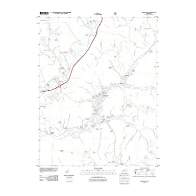
2011 Map of Morehead
USGS Topo · Published 2011About this map
Morehead dominates the central landscape of this Kentucky survey, serving as a hub where Triplett Creek and its many branches converge. The presence of Morehead State University and its nearby State University Farm highlights the town's role as a regional educational center. The map reveals a dense network of family history markers, with numerous burial sites such as Forest Lawn Memorial Gardens, Baldridge Cemetery Two, and the Caudill Cemetery scattered through the hollows. Surrounding settlements like Clearfield, Christy, and Brady are tucked into the valley floors, while the higher elevations are marked by distinctive landmarks including Limestone Knob, Amburgy Rocks, and the Triangle Lookout Tower. The terrain is characterized by deep depressions and ridges, named as Rodburn, Negro Hollow, and Rockwall Hollow, which dictate the winding paths of roads like Fallen Timber Branch Road.
Find a feature on this map
109 named features on this map. Tap any name to fly to it.
Don’t see what you’re looking for? This feature index may not catch every label — zoom into the map to look around manually.
Map Details
Editions of this 2011 Morehead Map
This is the sole edition of this map. No revisions or reprints were ever made.
Other maps of this area

1929 · Morehead
USGS Topo · 1:48,000

1929 · Salt Lick
USGS Topo · 1:62,500

1934 · Salt Lick
USGS Topo · 1:62,500

1935 · Morehead
USGS Topo · 1:62,500

1951 · Soldier
USGS Topo · 1:24,000

1951 · Cranston
USGS Topo · 1:24,000

1951 · Plummers Landing
USGS Topo · 1:24,000

1953 · Haldeman
USGS Topo · 1:24,000

1953 · Farmers
USGS Topo · 1:24,000

1953 · Bangor
USGS Topo · 1:24,000