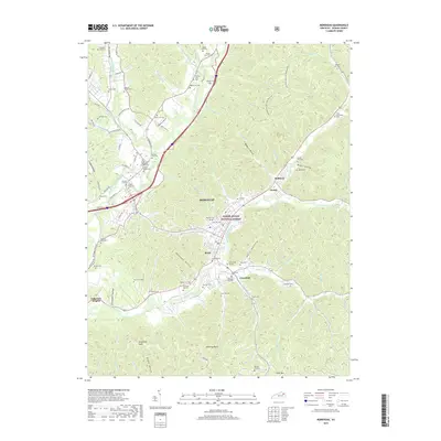
2019 Map of Morehead
USGS Topo · Published 2019About this map
Morehead serves as the central hub of this Rowan County landscape, situated where the North Fork and main branch of Triplett Creek converge. The topography is defined by the proximity of the Daniel Boone National Forest, with steep hillsides giving way to narrow hollows like Rockwall Hollow and Rodburn Hollow. Settlement patterns follow the creek beds and modern corridors of I-64 and KY 32, while the surrounding ridges are punctuated by distinctive natural features such as Limestone Knob and Amburgy Rocks.
Find a feature on this map
124 named features on this map. Tap any name to fly to it.
Don’t see what you’re looking for? This feature index may not catch every label — zoom into the map to look around manually.
Map Details
Editions of this 2019 Morehead Map
This is the sole edition of this map. No revisions or reprints were ever made.
Other maps of this area

1929 · Morehead
USGS Topo · 1:48,000

1929 · Salt Lick
USGS Topo · 1:62,500

1934 · Salt Lick
USGS Topo · 1:62,500

1935 · Morehead
USGS Topo · 1:62,500

1951 · Soldier
USGS Topo · 1:24,000

1951 · Cranston
USGS Topo · 1:24,000

1951 · Plummers Landing
USGS Topo · 1:24,000

1953 · Haldeman
USGS Topo · 1:24,000

1953 · Farmers
USGS Topo · 1:24,000

1953 · Bangor
USGS Topo · 1:24,000