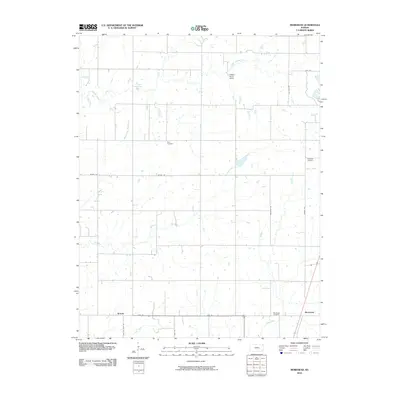
2010 Map of Morehead
USGS Topo · Published 2010About this map
Morehead and Brooks anchor this Kansas landscape, reflecting the enduring rural infrastructure of Neosho County in the early 21st century. The terrain is defined by a dense network of watercourses, including the southward-flowing Chetopa Creek and its tributary Washington Branch, alongside Dry Creek and Salt Creek. These streams dictate the placement of local homesteads and access roads like Bethel Rd and 6600 Rd. For those tracing family ties to the area, several key burial grounds are well-documented, notably Star Cemetery, Plainfield Cemetery, and Morehead Cemetery. The inclusion of Hidden Haven Camp near Little Chetopa Creek suggests the continued role of the land for community recreation. This survey captures the steady layout of the region, where the intersection of railroad lines and township roads maintains the traditional grid of the Kansas plains.
Find a feature on this map
20 named features on this map. Tap any name to fly to it.
Don’t see what you’re looking for? This feature index may not catch every label — zoom into the map to look around manually.
Map Details
Editions of this 2010 Morehead Map
This is the sole edition of this map. No revisions or reprints were ever made.
Other maps of this area

1886 · Fredonia
USGS Topo · 1:125,000

1886 · Iola
USGS Topo · 1:125,000

1886 · Independence
USGS Topo · 1:125,000

1886 · Parsons
USGS Topo · 1:125,000

1893 · Iola
USGS Topo · 1:125,000

1893 · Parsons
USGS Topo · 1:125,000

1894 · Fredonia
USGS Topo · 1:125,000

1894 · Independence
USGS Topo · 1:125,000

1904 · Iola
USGS Topo · 1:125,000

1905 · Independence
USGS Topo · 1:125,000