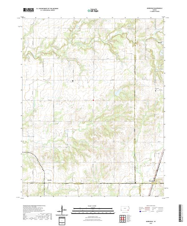
2022 Map of Morehead
USGS Topo · Published 2022About this map
Morehead sits at the intersection of four counties, anchoring a rural landscape defined by agricultural section lines and an intricate network of drainages. The local geography is shaped by Little Chetopa Cr and Chetopa Cr, which wind through the northern sections, while Drum Cr and Salt Cr carve the southern reaches. This modern survey shows the convergence of Wilson, Neosho, Labette, and Montgomery counties, providing a precise record of the political boundaries that bisect the small settlements of Morehead and Brooks.
Find a feature on this map
56 named features on this map. Tap any name to fly to it.
Don’t see what you’re looking for? This feature index may not catch every label — zoom into the map to look around manually.
Map Details
Editions of this 2022 Morehead Map
This is the sole edition of this map. No revisions or reprints were ever made.
Other maps of this area

1886 · Fredonia
USGS Topo · 1:125,000

1886 · Iola
USGS Topo · 1:125,000

1886 · Independence
USGS Topo · 1:125,000

1886 · Parsons
USGS Topo · 1:125,000

1893 · Iola
USGS Topo · 1:125,000

1893 · Parsons
USGS Topo · 1:125,000

1894 · Fredonia
USGS Topo · 1:125,000

1894 · Independence
USGS Topo · 1:125,000

1904 · Iola
USGS Topo · 1:125,000

1905 · Independence
USGS Topo · 1:125,000