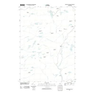
2010 Map of Morehouse Lake
USGS Topo · Published 2010About this map
East Canada Creek and its many tributaries, including Goldmine Stream and Brayhouse Brook, define this pocket of the Adirondacks where high elevations and dense hydrology intersect. The landscape is characterized by a series of named peaks such as Morehouse Mountain, Dead Horse Mountain, and Christian Lake Mountain, interspersed with numerous secluded water bodies like Jerseyfield Lake and DeBraine Lake.
Find a feature on this map
57 named features on this map. Tap any name to fly to it.
Don’t see what you’re looking for? This feature index may not catch every label — zoom into the map to look around manually.
Map Details
Editions of this 2010 Morehouse Lake Map
This is the sole edition of this map. No revisions or reprints were ever made.
Other maps of this area

1900 · Little Falls
USGS Topo · 1:62,500

1900 · Wilmurt
USGS Topo · 1:62,500

1901 · Lassellsville
USGS Topo · 1:62,500

1902 · Wilmurt
USGS Topo · 1:62,500

1903 · Lassellsville
USGS Topo · 1:62,500

1903 · Little Falls
USGS Topo · 1:62,500

1904 · Piseco Lake
USGS Topo · 1:62,500

1906 · Piseco Lake
USGS Topo · 1:62,500

1908 · Piseco Lake
USGS Topo · 1:62,500

1939 · Little Falls
USGS Topo · 1:62,500