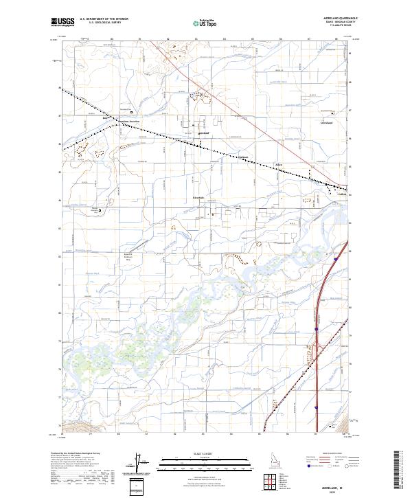
2023 Map of Moreland
USGS Topo · Published 2023About this map
The Snake River and Blackfoot River dominate the southern half of this landscape, creating a complex network of waterways that defined the agricultural development of Bingham County. The intricate system of man-made irrigation, including the Peoples Canal, Aberdeen-Springfield Canal, and Townsite Lateral, reveals how water was diverted from natural sources like Watson Slough to support the surrounding farmsteads. Settlements such as Moreland, Riverside, and Groveland serve as local hubs, while smaller railroad and road junctions like Aberdeen Junction and Aiken illustrate the historical transport patterns of the Snake River Plain. Genealogists will find several burial grounds across the area, including Moreland Cem and the Thomas Riverside Cem near the riverbanks. The presence of the Russell W Anderson Strip further highlights the local aviation and land-use history of this rural Idaho corridor.
Find a feature on this map
87 named features on this map. Tap any name to fly to it.
Don’t see what you’re looking for? This feature index may not catch every label — zoom into the map to look around manually.
Map Details
Editions of this 2023 Moreland Map
This is the sole edition of this map. No revisions or reprints were ever made.
Other maps of this area

1940 · Blackfoot
USGS Topo · 1:62,500

1943 · Blackfoot
USGS Topo · 1:62,500

1955 · Baldy Knoll
USGS Topo · 1:24,000

1955 · Rockford
USGS Topo · 1:24,000

1955 · Rose
USGS Topo · 1:24,000

1955 · Pingree
USGS Topo · 1:24,000

1955 · Idaho Falls
USGS Topo · 1:250,000

1958 · Idaho Falls
USGS Topo · 1:250,000
1971 · Fort Hall
USGS Topo · 1:24,000
1971 · Buckskin Basin
USGS Topo · 1:24,000