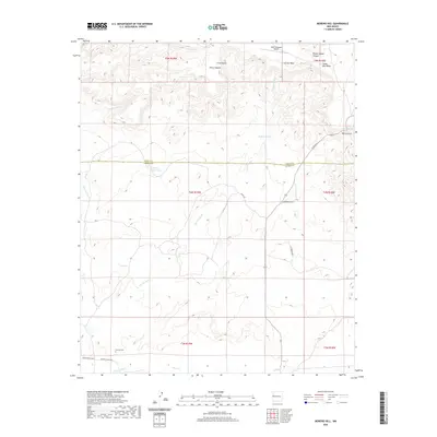
2020 Map of Moreno Hill
USGS Topo · Published 2020About this map
Moreno Hill sits at the northern edge of the Catron and Cibola county line, overlooking a landscape defined by seasonal drainages and high desert mesas. The area's ranching history is evidenced by numerous water catchments like Heffner Tank and Mueses Canyon Tank, which support the dry stretches between Carrizo Wash and Largo Cr. In the southwest corner, the Morelos Cem provides a specific point of interest for genealogists tracing early families in this remote corner of New Mexico. The terrain transitions from the prominent Santa Rita Mesa in the northeast down toward Perry Canyon and Circle Butte. Transportation across this section of the state is limited to rural routes such as Co RD 35 A and Henderson Way, while the presence of the High Lonesome Airport near the northern boundary reflects the modern necessity of aviation in such an expansive environment.
Find a feature on this map
28 named features on this map. Tap any name to fly to it.
Don’t see what you’re looking for? This feature index may not catch every label — zoom into the map to look around manually.
Map Details
Editions of this 2020 Moreno Hill Map
This is the sole edition of this map. No revisions or reprints were ever made.
Other maps of this area

1954 · Saint Johns
USGS Topo · 1:250,000

1957 · Saint Johns
USGS Topo · 1:250,000

1958 · Saint Johns
USGS Topo · 1:250,000

1962 · Saint Johns
USGS Topo · 1:250,000

1972 · Zuni Salt Lake
USGS Topo · 1:24,000

1972 · Lake Armijo
USGS Topo · 1:24,000

1972 · Twentytwo Spring
USGS Topo · 1:24,000

1972 · Fence Lake
USGS Topo · 1:24,000

1972 · Fence Lake SW
USGS Topo · 1:24,000

1972 · Cantaralo Spring
USGS Topo · 1:24,000