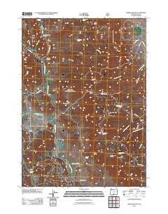
2011 Map of Morgan Butte
USGS Topo · Published 2011About this map
The Chewaucan River winds through this high-elevation landscape of Lake County, Oregon, creating a central corridor between numerous volcanic peaks and ridges. The 2011 topography is defined by prominent landmarks such as Morgan Butte, where the Morgan Butte Lookout provides a high vantage point over the surrounding terrain. To the south, the Parker Hills and Myers Butte rise above Myers Canyon, while the northern portion of the quadrangle is marked by Ennis Butte and McComb Butte.
Find a feature on this map
41 named features on this map. Tap any name to fly to it.
Don’t see what you’re looking for? This feature index may not catch every label — zoom into the map to look around manually.
Map Details
Editions of this 2011 Morgan Butte Map
This is the sole edition of this map. No revisions or reprints were ever made.
Other maps of this area

1955 · Klamath Falls
USGS Topo · 1:250,000

1958 · Klamath Falls
USGS Topo · 1:250,000

1964 · Coleman Point
USGS Topo · 1:24,000

1964 · Shoestring Butte
USGS Topo · 1:24,000

1964 · Clover Flat
USGS Topo · 1:24,000

1966 · Morgan Butte
USGS Topo · 1:24,000

1966 · Tucker Hill
USGS Topo · 1:24,000

1966 · Slide Mtn
USGS Topo · 1:24,000

1966 · Coglan Buttes
USGS Topo · 1:24,000

1966 · Coffeepot Creek
USGS Topo · 1:24,000