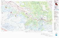
1983 Map of Morgan City
USGS Topo · Published 1983About this map
Bayou Teche winds through the heart of Acadiana in the early 1980s, serving as a historic corridor for settlements like New Iberia, Jeanerette, and Franklin. This survey illustrates the intricate relationship between the region's burgeoning industrial centers and its expansive wetlands, where the Southern Pacific RR and U.S. Highway 90 parallel the bayou's course. To the south, the map details the salt dome "islands" that rise above the marsh, including Avery Island and Weeks Island, which stand as topographical anomalies in the low-lying coastal landscape.
Find a feature on this map
56 named features on this map. Tap any name to fly to it.
Don’t see what you’re looking for? This feature index may not catch every label — zoom into the map to look around manually.
Map Details
Editions of this 1983 Morgan City Map
2 editions found
Other maps of this area

1892 · Gibson
USGS Topo · 1:62,500

1892 · Donaldsonville
USGS Topo · 1:62,500

1892 · Thibodaux
USGS Topo · 1:62,500

1894 · Bayou De Large
USGS Topo · 1:62,500

1897 · Gibson
USGS Topo · 1:62,500

1927 · Thibodaux NW
USGS Topo · 1:31,680

1932 · Lake Decade
USGS Topo · 1:62,500

1932 · Bayou Blanc
USGS Topo · 1:31,680

1932 · Abbeville SE
USGS Topo · 1:31,680

1932 · Abbeville NE
USGS Topo · 1:31,680