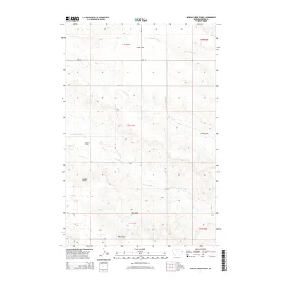
2014 Map of Morgan Creek School
USGS Topo · Published 2014About this map
Morgan Creek School sits at the heart of this Dawson County landscape, serving as a primary landmark for the surrounding rural sections. The terrain is characterized by expansive flat-topped elevations including Morgan Table in the north and Threemile Table to the south, which are intersected by a series of deep drainage channels. The presence of Coal Mine Coulee points to the region's geological and perhaps early industrial history, where erosion has carved significant pathways through the high plains. A network of county roads, including Road 521 and Road 523, connects these disparate points, following the natural contours of the land. Waterways such as Lower Sevenmile Cr and S Fork Thirteenmile Cr dictate the local geography, flowing around the prominent tables and through the numerous coulees that define this portion of eastern Montana.
Find a feature on this map
21 named features on this map. Tap any name to fly to it.
Don’t see what you’re looking for? This feature index may not catch every label — zoom into the map to look around manually.
Map Details
Editions of this 2014 Morgan Creek School Map
This is the sole edition of this map. No revisions or reprints were ever made.
Other maps of this area

1909 · Glendive
USGS Topo · 1:250,000

1954 · Glendive
USGS Topo · 1:250,000

1957 · Glendive
USGS Topo · 1:250,000

1958 · Glendive
USGS Topo · 1:250,000

1966 · Kolberg Ranch
USGS Topo · 1:24,000

1966 · Intake NW
USGS Topo · 1:24,000

1967 · Stipek
USGS Topo · 1:24,000

1972 · Red Top
USGS Topo · 1:24,000

1972 · Morgan Creek School
USGS Topo · 1:24,000

1972 · Poverty Flat West
USGS Topo · 1:24,000