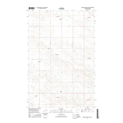
2017 Map of Morgan Creek School
USGS Topo · Published 2017About this map
Morgan Creek School stands as a central landmark in this Dawson County landscape, where the high, flat expanses of Morgan Table and Threemile Table overlook a complex network of seasonal drainage. The terrain is deeply incised by coulees, most notably Coal Mine Coulee and Plum Coulee, which suggest the historic importance of local resources and land use in this part of Montana. The water system is defined by the winding paths of Morgan Cr, Lower Sevenmile Cr, and the S Fork Thirteenmile Cr. A grid of local roads, such as RD 540 and RD 521, provides access across the various townships and ranges, illustrating the enduring township-and-range surveying system that shaped settlement in this expansive prairie region.
Find a feature on this map
21 named features on this map. Tap any name to fly to it.
Don’t see what you’re looking for? This feature index may not catch every label — zoom into the map to look around manually.
Map Details
Editions of this 2017 Morgan Creek School Map
This is the sole edition of this map. No revisions or reprints were ever made.
Other maps of this area

1909 · Glendive
USGS Topo · 1:250,000

1954 · Glendive
USGS Topo · 1:250,000

1957 · Glendive
USGS Topo · 1:250,000

1958 · Glendive
USGS Topo · 1:250,000

1966 · Kolberg Ranch
USGS Topo · 1:24,000

1966 · Intake NW
USGS Topo · 1:24,000

1967 · Stipek
USGS Topo · 1:24,000

1972 · Red Top
USGS Topo · 1:24,000

1972 · Morgan Creek School
USGS Topo · 1:24,000

1972 · Poverty Flat West
USGS Topo · 1:24,000