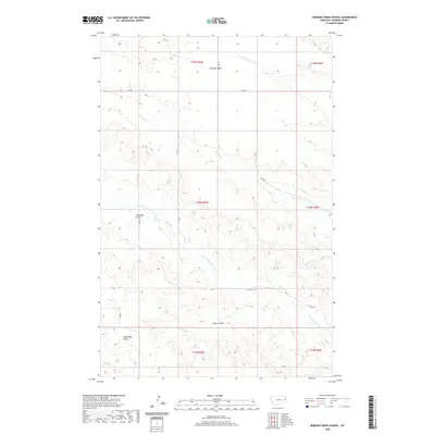
2020 Map of Morgan Creek School
USGS Topo · Published 2020About this map
Morgan Table dominates the northern reaches of this Dawson County landscape, where the terrain breaks into a series of drainage systems feeding into the Yellowstone River basin. The geography is defined by high flatlands like Threemile Table and deep incisions such as Cool Mine Coulee and Plum Coulee. These features represent the characteristic badlands topography of eastern Montana, where water has carved intricate patterns into the sedimentary layers. A network of rural routes, including RD 540 and RD 521, provides access through the various sections and townships of this ranching country. The hydrological network is led by Morgan Cr and Lower Sevenmile Cr, which wind through the township lines of T18N and T19N, illustrating the critical relationship between reliable water sources and the surveyed land divisions in this semi-arid region.
Find a feature on this map
20 named features on this map. Tap any name to fly to it.
Don’t see what you’re looking for? This feature index may not catch every label — zoom into the map to look around manually.
Map Details
Editions of this 2020 Morgan Creek School Map
This is the sole edition of this map. No revisions or reprints were ever made.
Other maps of this area

1909 · Glendive
USGS Topo · 1:250,000

1954 · Glendive
USGS Topo · 1:250,000

1957 · Glendive
USGS Topo · 1:250,000

1958 · Glendive
USGS Topo · 1:250,000

1966 · Kolberg Ranch
USGS Topo · 1:24,000

1966 · Intake NW
USGS Topo · 1:24,000

1967 · Stipek
USGS Topo · 1:24,000

1972 · Red Top
USGS Topo · 1:24,000

1972 · Morgan Creek School
USGS Topo · 1:24,000

1972 · Poverty Flat West
USGS Topo · 1:24,000