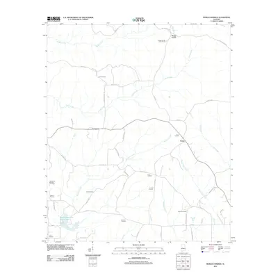
2011 Map of Morgan Springs
USGS Topo · Published 2011About this map
Morgan Springs and the village of Folsom anchor this rural landscape in northern Perry County, characterized by a dense network of family and community burying grounds. The terrain is defined by the winding paths of Big Prairie Creek, Polecat Creek, and Bogue Chitto Creek, which carve through the countryside alongside numerous local roads named for prominent area families. The prevalence of sites like Griffin Cemetery, DeYampert Cemetery, and Turner Cemetery suggests a deeply rooted local history and a genealogy-rich environment for researchers.
Find a feature on this map
51 named features on this map. Tap any name to fly to it.
Don’t see what you’re looking for? This feature index may not catch every label — zoom into the map to look around manually.
Map Details
Editions of this 2011 Morgan Springs Map
This is the sole edition of this map. No revisions or reprints were ever made.
Other maps of this area

1953 · Montgomery
USGS Topo · 1:250,000

1956 · Montgomery
USGS Topo · 1:250,000

1957 · Montgomery
USGS Topo · 1:250,000

1979 · Marion North
USGS Topo · 1:24,000

1979 · Scott Station
USGS Topo · 1:24,000

1979 · Morgan Springs
USGS Topo · 1:24,000

1979 · Marion South
USGS Topo · 1:24,000

1979 · Greensboro
USGS Topo · 1:24,000

1980 · Ingram
USGS Topo · 1:24,000
1980 · Newbern
USGS Topo · 1:24,000