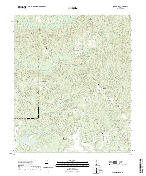
2024 Map of Morgan Springs
USGS Topo · Published 2024About this map
Morgan Springs and Folsom anchor this landscape along the border of Hale and Perry counties. The area is defined by its extensive collection of family and community burial grounds, including Griffin Cem, Harper Cem, and Walthill Cem, which serve as vital markers for genealogical research in this part of Alabama. The terrain is deeply carved by a network of waterways, most notably Big Brush Creek in the north and the meandering Bogue Chitto Creek in the east. These drainages, along with Big Prairie Creek, have historically dictated the placement of rural roads like Griffin Cemetery Rd and Mule Barn Rd. This map captures the persistent rural character of the region, where land divisions follow the Public Land Survey System lines of t20n r6e and surrounding townships, maintaining a settlement pattern focused on small crossroads and family landholdings.
Find a feature on this map
58 named features on this map. Tap any name to fly to it.
Don’t see what you’re looking for? This feature index may not catch every label — zoom into the map to look around manually.
Map Details
Editions of this 2024 Morgan Springs Map
This is the sole edition of this map. No revisions or reprints were ever made.
Other maps of this area

1953 · Montgomery
USGS Topo · 1:250,000

1956 · Montgomery
USGS Topo · 1:250,000

1957 · Montgomery
USGS Topo · 1:250,000

1979 · Marion North
USGS Topo · 1:24,000

1979 · Scott Station
USGS Topo · 1:24,000

1979 · Morgan Springs
USGS Topo · 1:24,000

1979 · Marion South
USGS Topo · 1:24,000

1979 · Greensboro
USGS Topo · 1:24,000

1980 · Ingram
USGS Topo · 1:24,000
1980 · Newbern
USGS Topo · 1:24,000