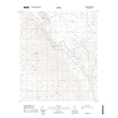
2020 Map of Morgantown
USGS Topo · Published 2020About this map
The Pearl River winds through this Marion County landscape, creating a series of sharp oxbows and supporting a network of creek systems including Cypress Cr and Holiday Creek. The topography is defined by the high elevations at White Bluff and Red Bluff, which overlook the river valley from the north and west. This modern survey illustrates the enduring rural settlement patterns of the region, anchored by the communities of Morgantown and Holly Springs. Genealogists will find several well-documented burial sites across the township lines, such as Holly Springs Cem, Mount Sinai Cem, and Oak Grove Cem. The local infrastructure is characterized by winding family-named roads like Slade Carlisle Rd and Clem Thornhill Rd, alongside specialized landmarks such as the Circle Bar Ranch Airport.
Find a feature on this map
64 named features on this map. Tap any name to fly to it.
Don’t see what you’re looking for? This feature index may not catch every label — zoom into the map to look around manually.
Map Details
Editions of this 2020 Morgantown Map
This is the sole edition of this map. No revisions or reprints were ever made.
Other maps of this area

1953 · Hattiesburg
USGS Topo · 1:250,000

1953 · Natchez
USGS Topo · 1:250,000

1956 · Natchez
USGS Topo · 1:250,000

1958 · Hattiesburg
USGS Topo · 1:250,000

1959 · Natchez
USGS Topo · 1:250,000

1970 · Columbia South
USGS Topo · 1:24,000

1970 · Sandy Hook NW
USGS Topo · 1:24,000

1970 · Kokomo
USGS Topo · 1:24,000

1970 · Bunker Hill
USGS Topo · 1:24,000

1970 · Darbun
USGS Topo · 1:24,000