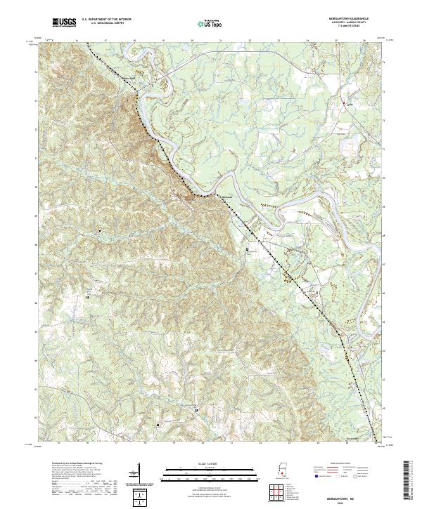
2024 Map of Morgantown
USGS Topo · Published 2024About this map
The Pearl River carves a winding path through this Marion County landscape, creating a distinct physical boundary between the upland forests and riverine bottomlands. This modern study of the area shows a rural geography where family names still mark the road network, as seen with John Thornhill Rd, Clem Thornhill Rd, and Billy Smith Rd. The local terrain is most notably defined by the Red Bluff escarpment, where significant relief breaks the typical Mississippi woodland patterns.
Find a feature on this map
68 named features on this map. Tap any name to fly to it.
Don’t see what you’re looking for? This feature index may not catch every label — zoom into the map to look around manually.
Map Details
Editions of this 2024 Morgantown Map
This is the sole edition of this map. No revisions or reprints were ever made.
Other maps of this area

1953 · Hattiesburg
USGS Topo · 1:250,000

1953 · Natchez
USGS Topo · 1:250,000

1956 · Natchez
USGS Topo · 1:250,000

1958 · Hattiesburg
USGS Topo · 1:250,000

1959 · Natchez
USGS Topo · 1:250,000

1970 · Columbia South
USGS Topo · 1:24,000

1970 · Sandy Hook NW
USGS Topo · 1:24,000

1970 · Kokomo
USGS Topo · 1:24,000

1970 · Bunker Hill
USGS Topo · 1:24,000

1970 · Darbun
USGS Topo · 1:24,000