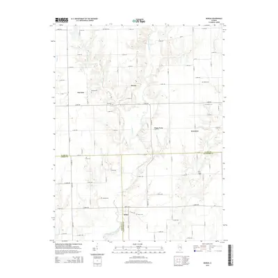
2015 Map of Moriah
USGS Topo · Published 2015About this map
Moriah and Moonshine anchor this rural landscape in eastern Illinois, where the borders of Clark, Jasper, and Crawford counties converge. The terrain is defined by the winding course of the North Fork Embarras River and its many tributaries, including Mount Br and Willow Cr, which carve a complex system of ridges and valleys through the central part of the quadrangle. Small unincorporated settlements like Hogue Town and Oak Point are scattered throughout, connected by a dense grid of rural roads and county routes.
Find a feature on this map
49 named features on this map. Tap any name to fly to it.
Don’t see what you’re looking for? This feature index may not catch every label — zoom into the map to look around manually.
Map Details
Editions of this 2015 Moriah Map
This is the sole edition of this map. No revisions or reprints were ever made.
Other maps of this area

1933 · Toledo
USGS Topo · 1:62,500

1936 · Casey
USGS Topo · 1:48,000

1938 · Toledo
USGS Topo · 1:62,500

1940 · Greenup
USGS Topo · 1:62,500

1942 · Casey
USGS Topo · 1:62,500

1943 · Greenup
USGS Topo · 1:62,500

1943 · Casey
USGS Topo · 1:62,500

1953 · Indianapolis
USGS Topo · 1:250,000

1956 · Indianapolis
USGS Topo · 1:250,000

1956 · Annapolis
USGS Topo · 1:62,500