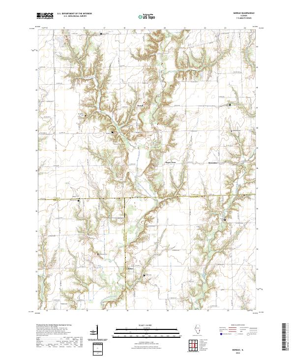
2024 Map of Moriah
USGS Topo · Published 2024About this map
Moriah sits at the center of this rural Illinois landscape, where the agricultural grid is interrupted by the winding corridors of the North Fork Embarras River and Mount Branch. This modern survey highlights a region defined by its small, traditional settlements and numerous family and community burial grounds, such as Restitution Cem and Baughman Cem. The geography is notably shaped by the tri-county junction of Clark, Jasper, and Crawford counties, which meet near the village of Bellair. In the eastern reaches, the oddly named Moonshine and Hogue Town represent the enduring local place-names of the Illinois prairie. The terrain features a distinctive ridge known as Backbone, which rises above the surrounding river bottoms and is marked by its own Backbone Cem. These features, along with a network of local roads like Co Hwy 26 and Co Hwy 2, illustrate a landscape that has maintained its rural character and genealogical heritage well into the twenty-first century.
Find a feature on this map
73 named features on this map. Tap any name to fly to it.
Don’t see what you’re looking for? This feature index may not catch every label — zoom into the map to look around manually.
Map Details
Editions of this 2024 Moriah Map
This is the sole edition of this map. No revisions or reprints were ever made.
Other maps of this area

1933 · Toledo
USGS Topo · 1:62,500

1936 · Casey
USGS Topo · 1:48,000

1938 · Toledo
USGS Topo · 1:62,500

1940 · Greenup
USGS Topo · 1:62,500

1942 · Casey
USGS Topo · 1:62,500

1943 · Greenup
USGS Topo · 1:62,500

1943 · Casey
USGS Topo · 1:62,500

1953 · Indianapolis
USGS Topo · 1:250,000

1956 · Indianapolis
USGS Topo · 1:250,000

1956 · Annapolis
USGS Topo · 1:62,500