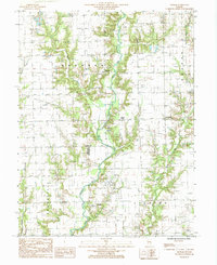
1985 Map of Moriah
USGS Topo · Published 1985About this map
Moriah and the surrounding agricultural landscapes of eastern Illinois appear here during the mid-1980s, revealing a region defined by the winding course of the North Fork Embarras River. Small settlements such as Moonshine, Hogue Town, and Bellair serve as local anchors within a grid of rural roads and section lines. The map captures the intersection of three counties—Clark, Jasper, and Crawford—while documenting the industrial footprint of the era through several marked Oil Field zones and a northern Quarry. Tributaries like Panther Creek, Mount Branch, and Willow Creek carve through the terrain, illustrating the natural drainage patterns that have shaped local farm boundaries and township divisions like Johnson and Orange for generations.
Find a feature on this map
17 named features on this map. Tap any name to fly to it.
Don’t see what you’re looking for? This feature index may not catch every label — zoom into the map to look around manually.
Map Details
Editions of this 1985 Moriah Map
This is the sole edition of this map. No revisions or reprints were ever made.
Other maps of this area

1933 · Toledo
USGS Topo · 1:62,500

1936 · Casey
USGS Topo · 1:48,000

1938 · Toledo
USGS Topo · 1:62,500

1940 · Greenup
USGS Topo · 1:62,500

1942 · Casey
USGS Topo · 1:62,500

1943 · Greenup
USGS Topo · 1:62,500

1943 · Casey
USGS Topo · 1:62,500

1953 · Indianapolis
USGS Topo · 1:250,000

1956 · Indianapolis
USGS Topo · 1:250,000

1956 · Annapolis
USGS Topo · 1:62,500