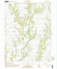
1998 Map of Moriah
USGS Topo · Published 2002About this map
North Fork Embarras River winds through this rural landscape on the border of Clark and Crawford counties, defining the agricultural and industrial character of the region. The map reveals a high concentration of active resource extraction, with numerous Oil Fields and a Quarry dotting the terrain near the small settlements of Moriah and Hogue Town. These industry markers are interspersed with small Cemeteries, providing specific points of interest for genealogists tracing local families in Johnson and Orange townships. The drainage patterns of Mounts Branch and Panther Creek illustrate the creek-bottom topography that influenced the placement of early homesteads and road networks. Farther south, the village of Bellair serves as a local hub near the winding river, while the oddly named Moonshine stands as a notable landmark in the eastern portion of the survey.
Find a feature on this map
19 named features on this map. Tap any name to fly to it.
Don’t see what you’re looking for? This feature index may not catch every label — zoom into the map to look around manually.
Map Details
Editions of this 1998 Moriah Map
This is the sole edition of this map. No revisions or reprints were ever made.
Other maps of this area

1933 · Toledo
USGS Topo · 1:62,500

1936 · Casey
USGS Topo · 1:48,000

1938 · Toledo
USGS Topo · 1:62,500

1940 · Greenup
USGS Topo · 1:62,500

1942 · Casey
USGS Topo · 1:62,500

1943 · Greenup
USGS Topo · 1:62,500

1943 · Casey
USGS Topo · 1:62,500

1953 · Indianapolis
USGS Topo · 1:250,000

1956 · Indianapolis
USGS Topo · 1:250,000

1956 · Annapolis
USGS Topo · 1:62,500