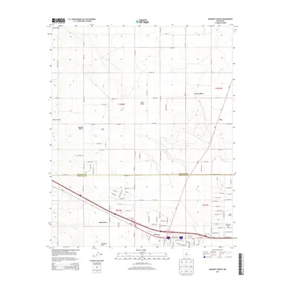
2013 Map of Moriarty North
USGS Topo · Published 2013About this map
Moriarty anchor this survey of the Estancia Valley as the Interstate 40 corridor facilitates modern expansion across the high plains. The map details a landscape where traditional landholdings like Johns Place, Martin Place, and Davis Ranch sit alongside newer residential developments. The terrain is defined by natural drainage patterns such as Bachelor Draw, Woodman Draw, and Salt Draw, which dictate the placement of roads like Dinkle Rd and Thompson Rd. The boundary between Santa Fe Co and Torrance Co bisects the northern section, marking a transition in local jurisdiction. Further north, the settlement of Otto and the small residential cluster of Homes Valley represent the slow northward stretch of the community into the open basins of the high desert.
Find a feature on this map
105 named features on this map. Tap any name to fly to it.
Don’t see what you’re looking for? This feature index may not catch every label — zoom into the map to look around manually.
Map Details
Editions of this 2013 Moriarty North Map
This is the sole edition of this map. No revisions or reprints were ever made.
Other maps of this area

1892 · San Pedro
USGS Topo · 1:125,000

1894 · Lamy
USGS Topo · 1:125,000

1917 · Estancia
USGS Topo · 1:125,000

1954 · Chilili
USGS Topo · 1:24,000

1954 · San Pedro
USGS Topo · 1:24,000

1954 · Edgewood
USGS Topo · 1:24,000

1954 · Santa Fe
USGS Topo · 1:250,000

1954 · Fort Sumner
USGS Topo · 1:250,000

1954 · Socorro
USGS Topo · 1:250,000

1956 · Edgewood
USGS Topo · 1:62,500