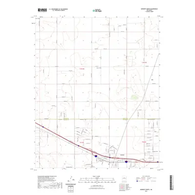
2023 Map of Moriarty North
USGS Topo · Published 2023About this map
Moriarty anchors the southern portion of this high plains landscape at the intersection of several major regional transit corridors. The settlement pattern across the Estancia Valley reflects a mix of established town centers and contemporary rural residential developments. Local history is grounded at the Carmel Cem near the southern boundary, while family-named landmarks and roads such as King Farm Rd and Martin Rd define the agricultural and residential plots north of town.
Find a feature on this map
109 named features on this map. Tap any name to fly to it.
Don’t see what you’re looking for? This feature index may not catch every label — zoom into the map to look around manually.
Map Details
Editions of this 2023 Moriarty North Map
This is the sole edition of this map. No revisions or reprints were ever made.
Other maps of this area

1892 · San Pedro
USGS Topo · 1:125,000

1894 · Lamy
USGS Topo · 1:125,000

1917 · Estancia
USGS Topo · 1:125,000

1954 · Chilili
USGS Topo · 1:24,000

1954 · San Pedro
USGS Topo · 1:24,000

1954 · Edgewood
USGS Topo · 1:24,000

1954 · Santa Fe
USGS Topo · 1:250,000

1954 · Fort Sumner
USGS Topo · 1:250,000

1954 · Socorro
USGS Topo · 1:250,000

1956 · Edgewood
USGS Topo · 1:62,500