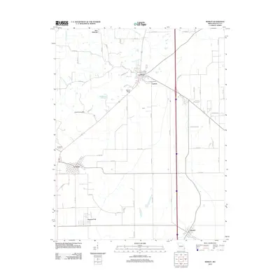
2012 Map of Morley
USGS Topo · Published 2012About this map
The lowlands of Scott County are defined by a network of drainage ways and small rises, most notably Benton Ridge and the Scott County Hills. This landscape is dotted with several well-established Missouri settlements, including Benton, Morley, and Blodgett. The mapping reveals a detailed road system ranging from major thoroughfares like Old Hwy 61 to residential streets such as Phillips Ave and Virginia St. Genealogists will find significant value in the location of several burial grounds, including Saint Denis Cemetery near Benton and Forrest Hills Cemetery outside Morley. Water features like Little Caney Creek and Caney Creek wind through the township, while Lamberts Lake sits west of the community of Lambert, showing how local hydrology influenced the placement of early homesteads and rail-aligned towns.
Find a feature on this map
61 named features on this map. Tap any name to fly to it.
Don’t see what you’re looking for? This feature index may not catch every label — zoom into the map to look around manually.
Map Details
Editions of this 2012 Morley Map
This is the sole edition of this map. No revisions or reprints were ever made.
Other maps of this area

1931 · Sikeston
USGS Topo · 1:62,500

1934 · Thebes
USGS Topo · 1:62,500

1934 · Morley
USGS Topo · 1:62,500

1934 · Sikeston
USGS Topo · 1:62,500

1939 · Sikeston
USGS Topo · 1:62,500

1939 · Charleston
USGS Topo · 1:62,500

1939 · Morley
USGS Topo · 1:62,500

1939 · Thebes
USGS Topo · 1:62,500

1949 · Paducah
USGS Topo · 1:250,000

1950 · Paducah
USGS Topo · 1:250,000