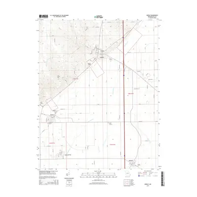
2015 Map of Morley
USGS Topo · Published 2015About this map
Benton Ridge and the Scott County Hills rise above the alluvial landscape of Scott County in this 2015 study of the Bootheel region. The map documents a cluster of established communities including Benton, Morley, Blodgett, and Haywood City, connected by a network of drainage systems like the Saint Johns Ditch and Blue Ditch. These artificial waterways represent the engineering history of the region, which transformed low-lying terrain into productive agricultural land. Genealogists will find exceptional value in the density of burial sites recorded here, from Saint Denis Cemetery in the north to the New Morley Cemetery and Blodgett Cemetery further south. The transition from the elevated Scott County Hills down to the flat, ditched plains highlights the geological diversity that has dictated settlement patterns and land use in this part of Missouri for generations.
Find a feature on this map
94 named features on this map. Tap any name to fly to it.
Don’t see what you’re looking for? This feature index may not catch every label — zoom into the map to look around manually.
Map Details
Editions of this 2015 Morley Map
This is the sole edition of this map. No revisions or reprints were ever made.
Other maps of this area

1931 · Sikeston
USGS Topo · 1:62,500

1934 · Thebes
USGS Topo · 1:62,500

1934 · Morley
USGS Topo · 1:62,500

1934 · Sikeston
USGS Topo · 1:62,500

1939 · Sikeston
USGS Topo · 1:62,500

1939 · Charleston
USGS Topo · 1:62,500

1939 · Morley
USGS Topo · 1:62,500

1939 · Thebes
USGS Topo · 1:62,500

1949 · Paducah
USGS Topo · 1:250,000

1950 · Paducah
USGS Topo · 1:250,000