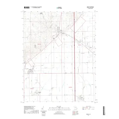
2017 Map of Morley
USGS Topo · Published 2017About this map
The town of Morley serves as a central hub in this Scott County landscape, where the agriculture of the Mississippi embayment meets the rising ground of the Scott County Hills. A series of small settlements including Benton, Blodgett, and New Hamburg are connected by a network of local roads and the Union Pacific railroad corridor. The area's history is deeply etched into the land through its numerous burial grounds, such as Saint Denis Cem near Benton and the separated Old Morley Cem and New Morley Cem sites. Evidence of significant drainage engineering is visible in the southern lowlands, where Saint Johns Ditch and Blue Ditch cut across the plains to manage the alluvial water table. The transition from the flatlands to the elevated Benton Ridge illustrates the unique topography that has shaped the development of these Missouri communities.
Find a feature on this map
96 named features on this map. Tap any name to fly to it.
Don’t see what you’re looking for? This feature index may not catch every label — zoom into the map to look around manually.
Map Details
Editions of this 2017 Morley Map
This is the sole edition of this map. No revisions or reprints were ever made.
Other maps of this area

1931 · Sikeston
USGS Topo · 1:62,500

1934 · Thebes
USGS Topo · 1:62,500

1934 · Morley
USGS Topo · 1:62,500

1934 · Sikeston
USGS Topo · 1:62,500

1939 · Sikeston
USGS Topo · 1:62,500

1939 · Charleston
USGS Topo · 1:62,500

1939 · Morley
USGS Topo · 1:62,500

1939 · Thebes
USGS Topo · 1:62,500

1949 · Paducah
USGS Topo · 1:250,000

1950 · Paducah
USGS Topo · 1:250,000