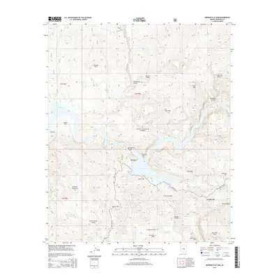
2014 Map of Mormon Flat Dam
USGS Topo · Published 2014About this map
Mormon Flat Dam controls the waters of the Salt River within the Tonto National Forest, creating the expansive reservoir of Canyon Lake. This 2014 survey documents the complex topography surrounding the settlement of Tortilla Flat, which remains a singular outpost along the winding course of State Hwy 88. The landscape is dominated by stark geologic formations, from the sheer heights of Satchin Cliff and Yachin Cliff to the prominent rising of Battleship Mtn. The map traces a network of drainages such as La Barge Cr and Tortilla Cr that carve through the Goldfield Mountains. Insights into local hydrology are preserved through the locations of numerous cattle tanks and remote springs like Hidden Water Spring and Brownie Tank, essential markers for understanding human and livestock movement across Hackberry Mesa and Mesquite Flat.
Find a feature on this map
46 named features on this map. Tap any name to fly to it.
Don’t see what you’re looking for? This feature index may not catch every label — zoom into the map to look around manually.
Map Details
Editions of this 2014 Mormon Flat Dam Map
This is the sole edition of this map. No revisions or reprints were ever made.
Other maps of this area

1900 · Florence
USGS Topo · 1:125,000

1902 · Florence
USGS Topo · 1:125,000

1904 · Desert Well
USGS Topo · 1:62,500

1904 · Ft. McDowell
USGS Topo · 1:62,500

1906 · Ft. McDowell
USGS Topo · 1:62,500

1906 · Desert Well
USGS Topo · 1:62,500

1907 · Roosevelt
USGS Topo · 1:125,000

1909 · Four Peaks
USGS Topo · 1:125,000

1912 · Roosevelt
USGS Topo · 1:125,000

1930 · Cave Creek
USGS Topo · 1:125,000