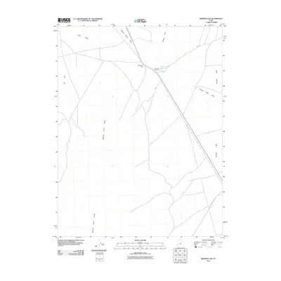
2010 Map of Mormon Gap
USGS Topo · Published 2010About this map
Mormon Gap serves as the focal point of this arid corridor in Millard County, where the topography transitions between the Mountain Home Range and the Burbank Hills. This 2010 digital survey captures a landscape defined by hydraulic engineering and seasonal water management, most notably the Mormon Gap Dam and its associated Mormon Gap Reservoir. These features suggest a reliance on captured runoff to support ranching or local transit through the desert. The drainage patterns are clearly delineated, showing the course of the Antelope Valley Wash as it cuts through the Antelope Valley, while the broad expanse of Snake Valley and the depression known as The Cove illustrate the vast, basin-and-range character of western Utah. A network of primitive roads, including Cowboy Rd, provides the only visible infrastructure across this isolated terrain.
Find a feature on this map
10 named features on this map. Tap any name to fly to it.
Don’t see what you’re looking for? This feature index may not catch every label — zoom into the map to look around manually.
Map Details
Editions of this 2010 Mormon Gap Map
This is the sole edition of this map. No revisions or reprints were ever made.
Other maps of this area

1949 · Garrison
USGS Topo · 1:62,500

1951 · Garrison
USGS Topo · 1:62,500

1953 · Richfield
USGS Topo · 1:250,000

1956 · Lund
USGS Topo · 1:250,000

1958 · Richfield
USGS Topo · 1:250,000

1960 · Lund
USGS Topo · 1:250,000

1960 · Burbank Hills
USGS Topo · 1:62,500

1971 · Mountain Home Pass
USGS Topo · 1:24,000

1971 · Halfway Summit
USGS Topo · 1:24,000

1971 · Tunnel Spring
USGS Topo · 1:24,000