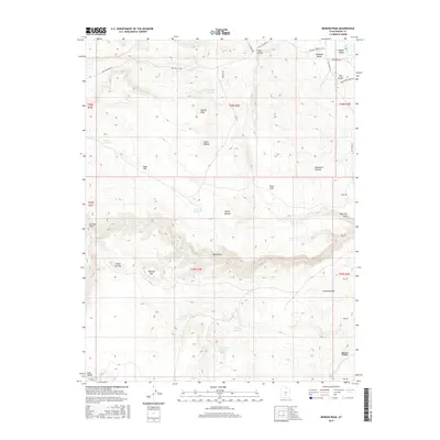
2017 Map of Moroni Peak
USGS Topo · Published 2017About this map
Moroni Peak and the curiously named Elsies Nipple dominate this high-desert landscape in Wayne County, Utah. The terrain is defined by a series of flats and benches, including Sage Flat, Terza Flat, and Bullhead Bench, which break up the higher elevations of the Awapa Plateau. Water management is central to the area's geography, evidenced by a network of catchments such as Long Hollow Reservoir, Woodys Reservoir, and Flat Top Reservoir.
Find a feature on this map
35 named features on this map. Tap any name to fly to it.
Don’t see what you’re looking for? This feature index may not catch every label — zoom into the map to look around manually.
Map Details
Editions of this 2017 Moroni Peak Map
This is the sole edition of this map. No revisions or reprints were ever made.
Other maps of this area

1885 · Fish Lake
USGS Topo · 1:250,000

1896 · Fish Lake
USGS Topo · 1:250,000

1952 · Loa 1 SE
USGS Topo · 1:24,000

1952 · Loa 1 NE
USGS Topo · 1:24,000

1953 · Loa 4 NE
USGS Topo · 1:24,000

1956 · Salina
USGS Topo · 1:250,000

1960 · Salina
USGS Topo · 1:250,000

1962 · Salina
USGS Topo · 1:250,000

1967 · Lyman
USGS Topo · 1:24,000
1969 · Smooth Knoll
USGS Topo · 1:24,000