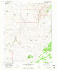
1969 Map of Smooth Knoll
USGS Topo · Published 1972About this map
High-altitude ranching and timber resources define this 1969 landscape along the border of Wayne and Garfield counties. The terrain is characterized by a sophisticated network of water management, evidenced by numerous catchments such as Mitts Reservoir, Blackburn Reservoir, and Pelham Hollow Reservoir which sustained livestock in this arid upland environment. Within the eastern portion of the Dixie National Forest, the map identifies specific timbered areas like Logging Grove and Peterson Grove, illustrating the managed nature of these public lands.
Find a feature on this map
30 named features on this map. Tap any name to fly to it.
Don’t see what you’re looking for? This feature index may not catch every label — zoom into the map to look around manually.
Map Details
Editions of this 1969 Smooth Knoll Map
This is the sole edition of this map. No revisions or reprints were ever made.
Other maps of this area

1885 · Fish Lake
USGS Topo · 1:250,000

1896 · Fish Lake
USGS Topo · 1:250,000

1952 · Loa 1 SE
USGS Topo · 1:24,000

1953 · Loa 4 NE
USGS Topo · 1:24,000

1956 · Salina
USGS Topo · 1:250,000

1960 · Salina
USGS Topo · 1:250,000

1962 · Salina
USGS Topo · 1:250,000
1969 · Flossie Knoll
USGS Topo · 1:24,000
1969 · Jakes Knoll
USGS Topo · 1:24,000
1969 · Moroni Peak
USGS Topo · 1:24,000