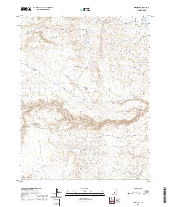
2023 Map of Moroni Peak
USGS Topo · Published 2023About this map
Moroni Peak and the curiously named Elsies Nipple dominate this high-desert landscape in Wayne County, Utah. This region of the Awapa Plateau is defined by a network of drainage basins and seasonal catchments that reflect a deep history of high-country grazing and land management. The presence of several small-scale water improvements, including Long Hollow Reservoir, Moroni Reservoir, and Rock Point Reservoir, indicates the vital importance of water storage for livestock and irrigation in this arid environment. Significant topographical landmarks like Bullhead Bench and the distinct summits of Big Flat Top and Little Flat Top provide clear reference points for those tracking family land use or historical grazing routes through Rabbit Valley and Wildcat Hollow. The map also details local access via Long Hollow Rd and Big Rocks Rd, marking the infrastructure of this secluded plateau.
Find a feature on this map
31 named features on this map. Tap any name to fly to it.
Don’t see what you’re looking for? This feature index may not catch every label — zoom into the map to look around manually.
Map Details
Editions of this 2023 Moroni Peak Map
This is the sole edition of this map. No revisions or reprints were ever made.
Other maps of this area

1885 · Fish Lake
USGS Topo · 1:250,000

1896 · Fish Lake
USGS Topo · 1:250,000

1952 · Loa 1 SE
USGS Topo · 1:24,000

1952 · Loa 1 NE
USGS Topo · 1:24,000

1953 · Loa 4 NE
USGS Topo · 1:24,000

1956 · Salina
USGS Topo · 1:250,000

1960 · Salina
USGS Topo · 1:250,000

1962 · Salina
USGS Topo · 1:250,000

1967 · Lyman
USGS Topo · 1:24,000
1969 · Smooth Knoll
USGS Topo · 1:24,000