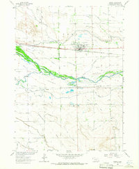
1963 Map of Morrill
USGS Topo · Published 1965About this map
The North Platte River carves through the heart of this landscape, flanked by an extensive network of irrigation infrastructure and historical transportation routes. The town of Morrill stands as a focal point, served by the Chicago Burlington and Quincy railroad, while South Morrill and the Hartman area sit further south along the Union Pacific line. This 1963 survey illustrates the agricultural dependence on water management, showing numerous systems like the Tri-State Canal, Ramshorn Canal, and the Enterprise Canal that divert river water to the surrounding Dutch Flats. Traces of western migration are preserved through the various segments of the Emigrant Trail that parallel the river. Local heritage is further marked by the Forest Lawn Cem, Caldwell Cem, and a designated Historical Marker located near the river crossing.
Find a feature on this map
34 named features on this map. Tap any name to fly to it.
Don’t see what you’re looking for? This feature index may not catch every label — zoom into the map to look around manually.
Map Details
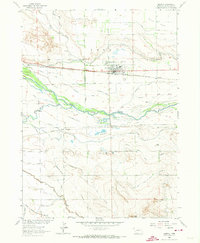
Editions of this 1963 Morrill Map
2 editions found
Other maps of this area

1896 · Patrick
USGS Topo · 1:125,000

1898 · Scotts Bluff
USGS Topo · 1:125,000

1899 · Goshen Hole
USGS Topo · 1:125,000

1899 · Whistle Creek
USGS Topo · 1:125,000

1954 · Scottsbluff
USGS Topo · 1:250,000

1954 · Torrington
USGS Topo · 1:250,000

1954 · Cheyenne
USGS Topo · 1:250,000

1955 · Alliance
USGS Topo · 1:250,000

1957 · Alliance
USGS Topo · 1:250,000

1958 · Cheyenne
USGS Topo · 1:250,000