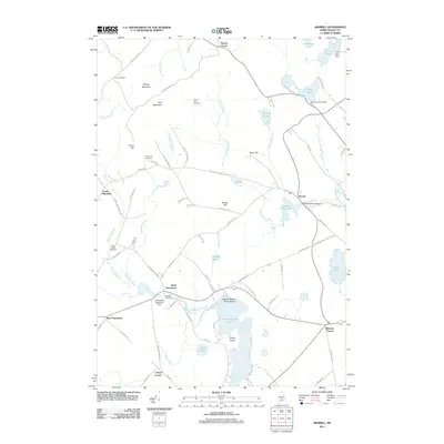
2011 Map of Morrill
USGS Topo · Published 2011About this map
Quantabacook Lake and the Passagassawakeag River dominate this Waldo County landscape, where the town of Morrill serves as a central hub. The geography is defined by a series of prominent rises including Spears Mountain, Frye Mountain, and Pierce Hill, which overlook a network of smaller ponds and streams. This inland Maine region maintains its rural character through established crossroads such as North Searsmont, West Searsmont, and Center Montville. The presence of Smiths Millpond Dam and Ruffingham Meadows Dam suggests a history of water management and local industry tied to the flow of Bartlett Stream and Wilson Brook. For those researching local families, the map identifies several burial grounds, including Carter Cemetery, Sunny Side Cemetery, and Green Wood Cemetery. The distribution of these sites alongside historical corridors like Robinson Schoolhouse Rd and Old Route 3 provides a clear view of how these communities developed through the years.
Find a feature on this map
80 named features on this map. Tap any name to fly to it.
Don’t see what you’re looking for? This feature index may not catch every label — zoom into the map to look around manually.
Map Details
Editions of this 2011 Morrill Map
This is the sole edition of this map. No revisions or reprints were ever made.
Other maps of this area

1915 · Belfast
USGS Topo · 1:62,500

1916 · Liberty
USGS Topo · 1:62,500

1917 · Belfast
USGS Topo · 1:62,500

1926 · Burnham
USGS Topo · 1:62,500

1932 · Brooks
USGS Topo · 1:62,500

1941 · Belfast
USGS Topo · 1:62,500

1942 · Liberty
USGS Topo · 1:62,500

1948 · Bangor
USGS Topo · 1:250,000

1950 · Belfast
USGS Topo · 1:50,000

1950 · Liberty
USGS Topo · 1:50,000