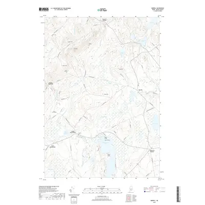
2018 Map of Morrill
USGS Topo · Published 2018About this map
Quantabacook Lake anchors the southern portion of this landscape, its waters dotted with Wood Island, Sheep Island, and Merrill Point. The Waldo County terrain is marked by significant elevations such as Spears Mtn and Frye Mtn, which overlook a network of streams and bogs including Smiths Millpond Bog and Greers Bog. This era of the region’s development is characterized by numerous small settlements and family-named landmarks connected by rural routes like Robinson Schoolhouse Rd and Old Co Rd.
Find a feature on this map
76 named features on this map. Tap any name to fly to it.
Don’t see what you’re looking for? This feature index may not catch every label — zoom into the map to look around manually.
Map Details
Editions of this 2018 Morrill Map
This is the sole edition of this map. No revisions or reprints were ever made.
Other maps of this area

1915 · Belfast
USGS Topo · 1:62,500

1916 · Liberty
USGS Topo · 1:62,500

1917 · Belfast
USGS Topo · 1:62,500

1926 · Burnham
USGS Topo · 1:62,500

1932 · Brooks
USGS Topo · 1:62,500

1941 · Belfast
USGS Topo · 1:62,500

1942 · Liberty
USGS Topo · 1:62,500

1948 · Bangor
USGS Topo · 1:250,000

1950 · Belfast
USGS Topo · 1:50,000

1950 · Liberty
USGS Topo · 1:50,000