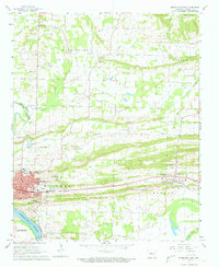
1961 Map of Morrilton East
USGS Topo · Published 1973About this map
Morrilton and Plumerville anchor this river-valley landscape during the early 1960s, defined by the Arkansas River and the transit corridor of the Missouri Pacific railroad. The map preserves a distinct record of the region’s social and religious infrastructure, including the Sacred Heart Cem, Gorman Chapel, and Union Hill Ch. Along the southern bank, the Bentley district sits near the river's edge, while the northern hills are home to the Hickory Hill settlement and its namesake Hickory Hill Sch.
Find a feature on this map
58 named features on this map. Tap any name to fly to it.
Don’t see what you’re looking for? This feature index may not catch every label — zoom into the map to look around manually.
Map Details
Editions of this 1961 Morrilton East Map
3 editions found
Other maps of this area

1889 · Morrilton No. 3
USGS Topo · 1:62,500

1892 · Morrillton
USGS Topo · 1:125,000

1894 · Morrillton
USGS Topo · 1:125,000

1956 · Russellville
USGS Topo · 1:250,000

1961 · Menifee
USGS Topo · 1:24,000

1961 · Perryville
USGS Topo · 1:24,000

1961 · Morrilton East
USGS Topo · 1:24,000

1961 · Morrilton West
USGS Topo · 1:24,000

1961 · Houston
USGS Topo · 1:24,000

1961 · Gleason
USGS Topo · 1:24,000